
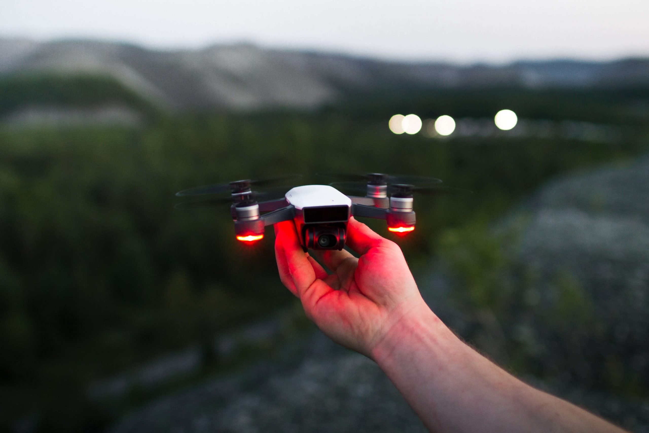

Before going in-depth about the types of drones for land surveyors, let us look at some of the applications of drones in our daily life.
Nowadays drones have found immense importance in our daily life, especially in professional life. people are taking huge benefits from drones in different ways for example; land surveying, people taking care of cattle, realtors trying to sell agricultural or rural land and property. National Park Service rangers or farmers evaluating soil quality, among so many other uses.
Benefits of using drones in land surveying
Table of Contents
1 Safety Of Employees: drones have made it safer for us to take a survey of a given area without putting ourselves in danger. Land surveyors need not put themselves at inaccessible terrain to collect accurate or aggregate data. With the help of the transmitter, one can control the drones safely and securely for such data collection
2 Time-Saving: with life getting busier and time getting shorter, the use of this technology in land surveying will cut extra hours of manual land surveys. drone mapping will reduce the time required to shift heavy equipment from one location to another for land surveying.
3 Project’s Budget: Budget – everyone’s favorite word. Every land surveyor or commoner wants to get the thing done in the allocated budget. The beauty of drone technology is that it will benefit more than its cost. It takes almost a month to map a 100-acre site in traditional ways. But Mapping with the drone will reduce this time to half an hour or less than that. Which will result in increased productivity?
4 Single Tool: land surveyors now use drones with exclusive functions to replace traditional theodolites, infrared reflectors, and GPS. Without all the heavy lifting and exhaustion drones can perform the task that the aforementioned tools used to perform. This would, in turn, allow the surveyors to be safer, spend less time on each site trip, and save the budget.
Things to look for in drones for land surveying

1 flying time in one go
2 charging time
3 ease of operating a drone
4 image or video quality
5 drone flying range
6 stability
Now we look at each of these features separately :
Flying time in one go :
It’s important to find out the flying time in one flight of any drone before you make up your mind. normally different drones offer 5 to 10 minutes flying time but, some drones like (DJI Phantom 4 Pro) now offer up to 30 minutes flying time.
charging time :
it’s useless to purchase any electronic device that keeps you busy in charging it. Drones also require charging, normally it gets up to 90 minutes to recharge a drone’s battery.
ease of operating a drone :
with technology making life easier. Land surveyors would feel relaxed while using drones if it has functions like dodging obstacles when the drone is flying on auto mode, the first-person view on screen in the transmitter, fpv on mobile or tablet through live video, flying back of drones to launchpad and so on.
image or video quality :
most cheap drones now offer an HD (720MP) camera, which may not be as good as it should be for professional work like land mapping. But some advanced drones offer the possibility to record a video in Ulta HD (4K).
Drone flying range :
it is desirable to have a long flying range drone. but the connection should not be lost with a transmitter in a long-range flight. if you lose sight of drone and want it to get back, return home function is also desirable in your drones.
stability:
stability is critical for all the tasks conducted by drones. It makes the drone move in the direction of your choice through a transmitter. Gyro is an instrument used in the drone to make it stable.
while some of the advanced drones use sensors, GPS for this function in the drones.
now let us talk about the type of drones for land surveyors based on these characteristics.
1. DJI Phantom 4 pro

the phantom is one of the first models of drones that appeared in the market. Phantom 4 Pro comes with advanced features that have totally shaken the market.
It has a flying time of up to 30 minutes. which will be sufficient to survey any site with much ease. this will reduce your worry of recharging a drone and in-process affecting your survey.battery takes approximately 90 minutes to recharge in one go.
DJI Phantom 4 Pro is really easy to operate with its futuristic options like auto mode flying, dodging obstacles during flying, allowing you to save your precious shots into SD card.
it records a video in ultra HD (4k) and directly Livestream video to your smartphone or tablets. This provides flexibility to land surveyors to have the first-person view on hand.
the quadcopter can operate on auto mode with the ability to avoid any obstacles in its way.it has the amazing option to follow the path drawn by the user on the screen of remote control.
DJI Phantom 4 pro range is 7 kilometers or up to 5 miles, if the drone loses connection with the transmitter it will automatically return to the place of its take-off.
2. Autel Robotics X-Star Premium Drone
this drone is also similar to DJI Phantom 4 Pro, but its bright orange color helps in the identification of drone from a respectable distance in the air. The orange color does not blend in the sky or clouds.
it has a flying time of up to 25 minutes and takes further 90 minutes to recharge a battery. This is a bit shorter than DJI phantom 4 pro but still, 25 minutes of flight is enough to map a site properly to collect data.
the autonomous flight mode and dual GPS/GLONASS satellite positioning system keeps it stable in the air, this also makes it easy to operate.
it allows the land surveyor to record a video in ultra HD (4k). the camera is attached to a gimble which helps is rotating the camera in 108 degrees without having to rotate a drone.
the range of this drone is 1.9 kilometers or 1.2 miles. significantly lower than DJI Phantom 4 Pro..
3. DJI Mavic Pro

it is also a big winner in the advanced level drones market.DJI Mavic Pro is a foldable drone that makes it compatible and highly appreciable.
like DJI Phantom 4 Pro, it also offers 30 minutes of flight time but recharging takes a bit longer than its counterparts. The battery takes 120 minutes to recharge. The flight time is almost similar to DJI Phantom 4 Pro but more than autel robotics x star premium drones.
the stability and precision in flight are achieved through GPS flight mode.this will help the user to get sharp images. also, the drone has dodging obstacles ability while flying on auto mode.
it comes with a 4K camera attached with an integrated gimbal. this really facilitates the rotation of the camera without having to rotates or move the entire drone.
the flying range of DJI Mavic Pro is up to 5 miles. With drone having a feature of returning back to its take-off place in case the connection gets interrupted with a transmitter.
due to its foldable and compact design, DJI Mavic pro rates highly in users from travelers to adventure lovers and especially land surveyors.
4. Yuneec Typhoon H Pro
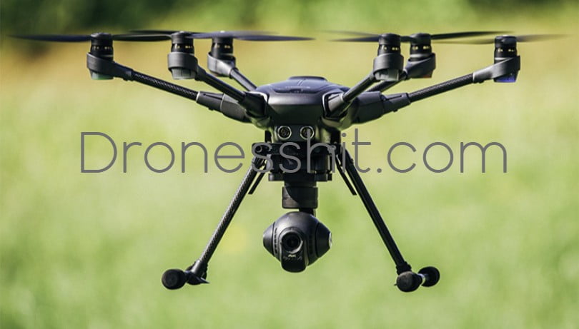
Yuneec Typhoon H Pro also comes with unique features that most professional land surveyors love, among these, are Multiple Intelligent Flight Modes.
its flying time is 25 minutes per flight and the battery will recharge in 150 minutes approximately. It has a flight range of 1.6 kilometers or 1 mile.
stability is achieved through H’s Intel RealSense Technology with collision avoidance technology in it. Plus, the remote control comes with an embedded screen that gives land surveyor FPV(first-person view).
like other advanced drones, Yuneec Typhoon H Pro records a video in Ultra HD (4K). The camera is attached to a gimble that allows a user to take a dream shot without much effort.
The multi intelligent flight modes include
1 Orbit me: the drone will follow a circular path around you while keeping the camera on you.
2 Point of interest: the pilot can mark a subject or site and it will orbit that subject autonomously.
3 Journey: the Yuneec Tyohooe h pro will go up to 150 meters to take an aerial Selphie.
4 Curve Cable Cam: program an invisible route for typhoon h pro to follow while you control the camera only.
5 Follow me or Watch me: the drone will follow you wherever you go or will keep the camera on you all the time
6 Return to Home: by switching to Home Mode, it will return back and will land within 8 meters (26 feet) near you.
[table id=1 /]
Recommendations
If you are already having a drone and want to go to the next level then these drones are the best options for you.however for the newbie these drones are one of the best options if they want to jump-start their career as a land surveyor.
keeping in view the characteristics defined above.DJI Phantom 4 Pro is the most suitable choice. With so many advanced and easy to use features.
https://waterfallmagazine.com
I’m really enjoying the design and layout of your blog.
It’s a very easy on the eyes which makes it much more pleasant for me to come here and visit
more often. Did you hire out a designer to create your theme?
Great work!
Thank you so much. At last, I found an article which
I am searching for quite a long time. I hope
that it will help me .
Best regards,
Balle Schneider
A round of applause for your blog post.Much thanks again. Really Cool.